Sometimes a 7-hour hike is just what the doctor ordered. Who can argue with views like this?
A couple weeks ago, I had been feeling pretty depressed (read about it at the end of this post), and even though I didn’t want to do it, I began forcing myself to exercise. One of those workouts was a long-planned hike with my buddy Jeff to Inspiration Point in the San Gabriel Mountains. Jeff and I had been talking about doing this 10-mile hike for months – ever since our Charlie Chaplin-inspired adventure in Acton – and I didn’t want to bail, no matter how depressed.
The hike began on a trail I’ve done a couple times before. The trailhead is at the Cobb Estate in Altadena, where a big mansion once stood, on the edge of a forest that’s now thought to be haunted. The 2.5-mile trail winds its way up to Echo Mountain, which, a hundred years ago, was home to a hotel that was only reached by funicular. That hotel is long gone – it burned to the ground in 1900 – and I got some awesome pics at the ruins when I hiked there last year with my friend Jonathan.
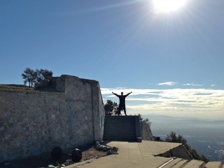
Jeff and I took our first little break when we reached those ruins. Here I am on the steps that led to the hotel’s front door.
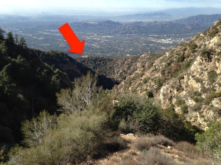
Everything after this was brand new to me. Instead of heading back down (which is what Jonathan and I did), Jeff and I continued upward, higher into the mountains. The trail had lots of switchbacks, and it wasn’t long before the Echo Mountain hotel ruins (the red arrow is pointing at them) were far away… and far below us:
And we still had a ways to go to our destination! We were headed to Inspiration Point, another 2.5 miles above Echo Mountain, which was also home to popular turn-of-the-century tourist attractions, including a small hotel, restaurant, gift shop, and a fox farm, all of which were accessible the Mount Lowe Railroad, which, like the funicular, was abandoned and demolished in the 1930s.
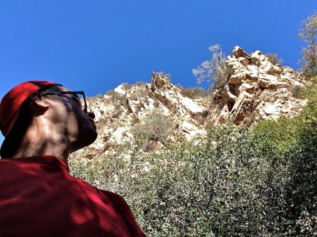
Getting to Inspiration Point required another hour or so of hiking up a mountain, on a trail that wove in and out of canyons. We passed some cool rock formations.
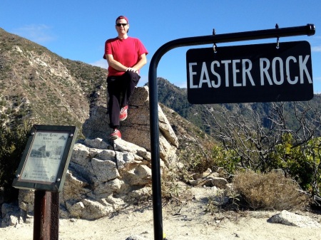
Eventually, Inspiration Point came into view, and shortly thereafter, we were there. Well, kinda. We got distracted by a nearby rocky peak, and went off to explore it. It turned out to be Easter Rock, where, in the 1920s, worshippers gathered at sunrise on Easter morning to hold church services.
We descended Easter Rock a different way than we went up it, thinking there was an cleared trail back down to a fire road, but there wasn’t. We negotiated our way down a rocky slope that was covered in all sorts of prickly shrubbery, and then wandered down the fire road for over a mile, away from Inspiration Point. We later learned that this road, a hundred years ago, was home to a scenic railroad. Riders boarded a single open-air train car, and were pushed down the track a total of three miles by a mule named Herbert. Herbert pushed them, as opposed to pulling them, so the dust he kicked up wouldn’t fly in the riders’ faces.
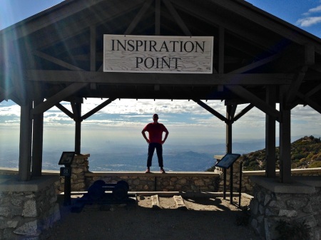
Our little Easter Rock and fire road detour took more than an hour, but we eventually ended up at Inspiration Point, and I was ready for a break and a snack (an apple and a fruit-and-nut bar that I brought). There’s a covered pavilion at Inspiration Point, with picnic tables and historical markers, so it’s a great place to relax.
A selfie with Jeff:
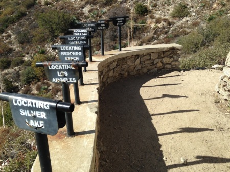
There’s also a series of pipes set up that help point out the different parts of Los Angeles, because you can see a lot from Inspiration Point. These aren’t telescopes – just pipes that you can look through to get your bearings.
I didn’t see any ostriches, but I’m pretty sure this pipe was pointed at South Pasadena, which was home to ostrich farms before developers turned it into residential neighborhoods:
Jeff, who hikes Inspiration Point regularly (he also runs it, because he’s a nationally-ranked trail runner), is familiar with all the trails up here, so we took a different trail back down to Echo Mountain. This trail took us to Sunset Point (which is probably more impressive at sunset, because it faces due west)…
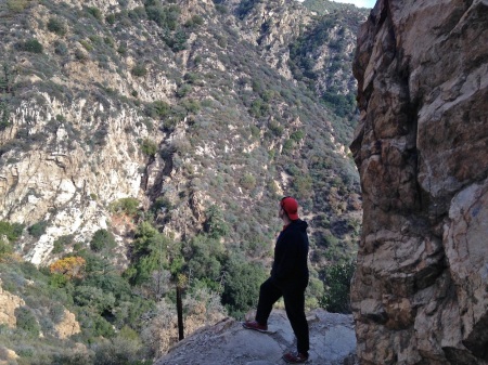
…and around some rocky curves with pretty steep drop-offs:
We also passed another landmark just before hitting the trail junction near Echo Mountain: the remains of an observatory that got destroyed in an 1928 windstorm. All that remains is the concrete pillar that the telescope was mounted on:
Once we got back to Echo Mountain, we got back on the trail we came up, and descended the final 2.5 miles to our cars.
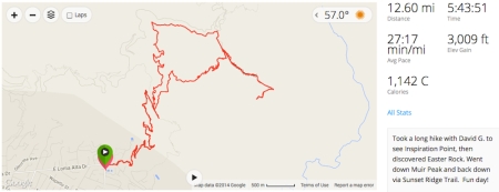
Jeff has a Garmin, which is a fancy GPS-based gizmo that tracks nearly everything, and the statistics for our hike are super impressive:
- 12.6 miles – by far my longest mountain hike. (I once did a 15-mile urban hike through the Silver Lake neighborhood)
- 3,000-foot elevation gain!
- 5 hours, 43 minutes of hiking. (The Garmin only tracked the time when we were moving. Add in the breaks we took, and the time ends up being around seven hours.)
I was sore by the time I got home, and sore the next day, too. But the soreness was worth it, because it was a fantastic hike and workout, and one that I think helped me get out of my depression. Plus, Jeff is a great workout buddy. I already have ideas for another record-breaking workout we could do together… we just gotta get it on the books!
Keep it up, David!
—————————
Follow me on Facebook, Twitter, and Google+. There’s also a “Sign Me Up” box at the top of the right-hand column on this page where you can subscribe to receive new posts via email!





Very cool! I have not done a lot of hiking, but I have been hiking with Jeff, and it was one Of my favorite adventures!
Jeff sure is a good hiking pal. That’s the truth.
Aww, thanks Karen! Red Rock (Turtlehead) was one of my favorite adventures, as well!
Wow, awesome hike, but I have to say my Mom “mode” kicked in looking at the pics of precipices and I’m glad you were with Jeff who knew the trails. Mom’s don’t like headlines such as: “searching for two men lost in Altadena”.
How about the headline “Searching for Two Hikers in Mountains That Pumas and Bears Call Home”? Jeff’s seen a bear while hiking on that mountain. I was so jealous!
I love these pictures and your description! I have been wanting to do that hike, at least to the hotel ruins, but still haven’t. You’ve inspired me to actually get it done. Thank you! And Keep It Up David!
GO DO IT! I hope you enjoy it. The hotel ruins is one of my favorite places in LA!
Wait a Minute…Inspiration Point is the make-out place on “Happy Days”
I’ve never seen “Happy Days,” Pat, but if you’re angling to make out with me… well, get in line! 🙂
Wow, what a hike & such a perfect way to spend your day. The views look beautiful. And that data from the Garmin is a cool way to see the ground you two covered, 12.6 miles going up and down hills is impressive!
Thanks! So glad it was a clear day. A little clearer and we wouldn’t seen the ocean!